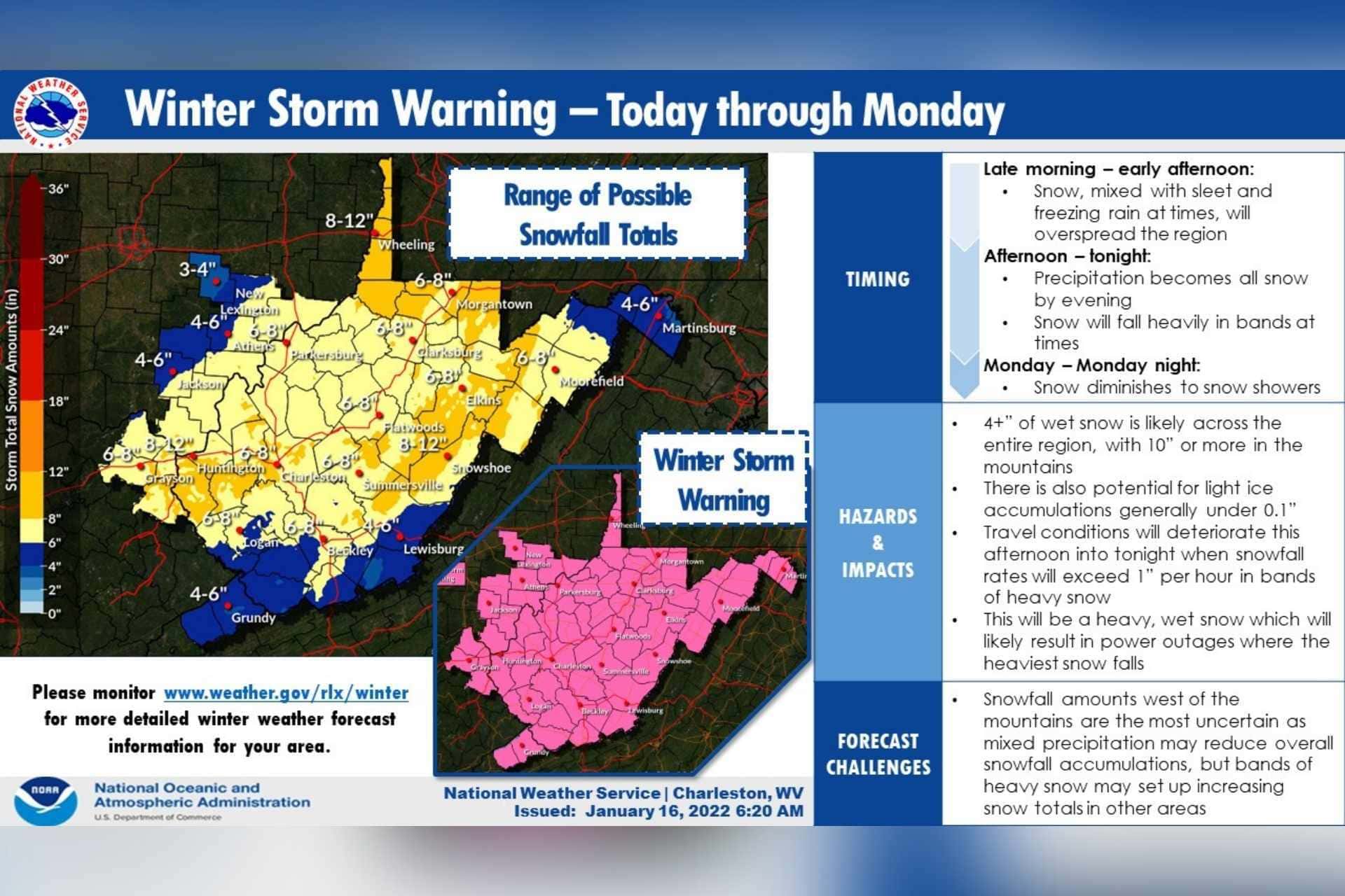
BUCKHANNON — A winter storm is expected to blow into central West Virginia late Sunday morning or early in the afternoon, bringing with it ice, sleet and several inches of snow.
The latest update from the Charleston office of the National Weather Service slightly lowered the snowfall totals expected.
“Heavy mixed precipitation expected,” the winter storm warning reads. “Total snow and sleet accumulations of 4 to 7 inches and ice accumulations of a light glaze.”
The winter storm warning runs through 1 p.m. Monday.
“Travel could be very difficult to impossible,” the NWS warns. “The hazardous conditions could impact the morning commute. Snow may mix with sleet and freezing rain before transitioning to all snow this evening. Expect reduced visibilities at times in heavy snow. If you must travel, keep an extra flashlight, food, and water in your vehicle in case of an emergency.”
Schools are already scheduled to be closed Monday for Martin Luther King, Jr. Day.
The snow will taper off Monday, although cold temperatures should remain throughout the week, with highs in the 20s and 30s and lows dipping into the teens. Wednesday could reach as high as the mid-40s before more frigid air returns.