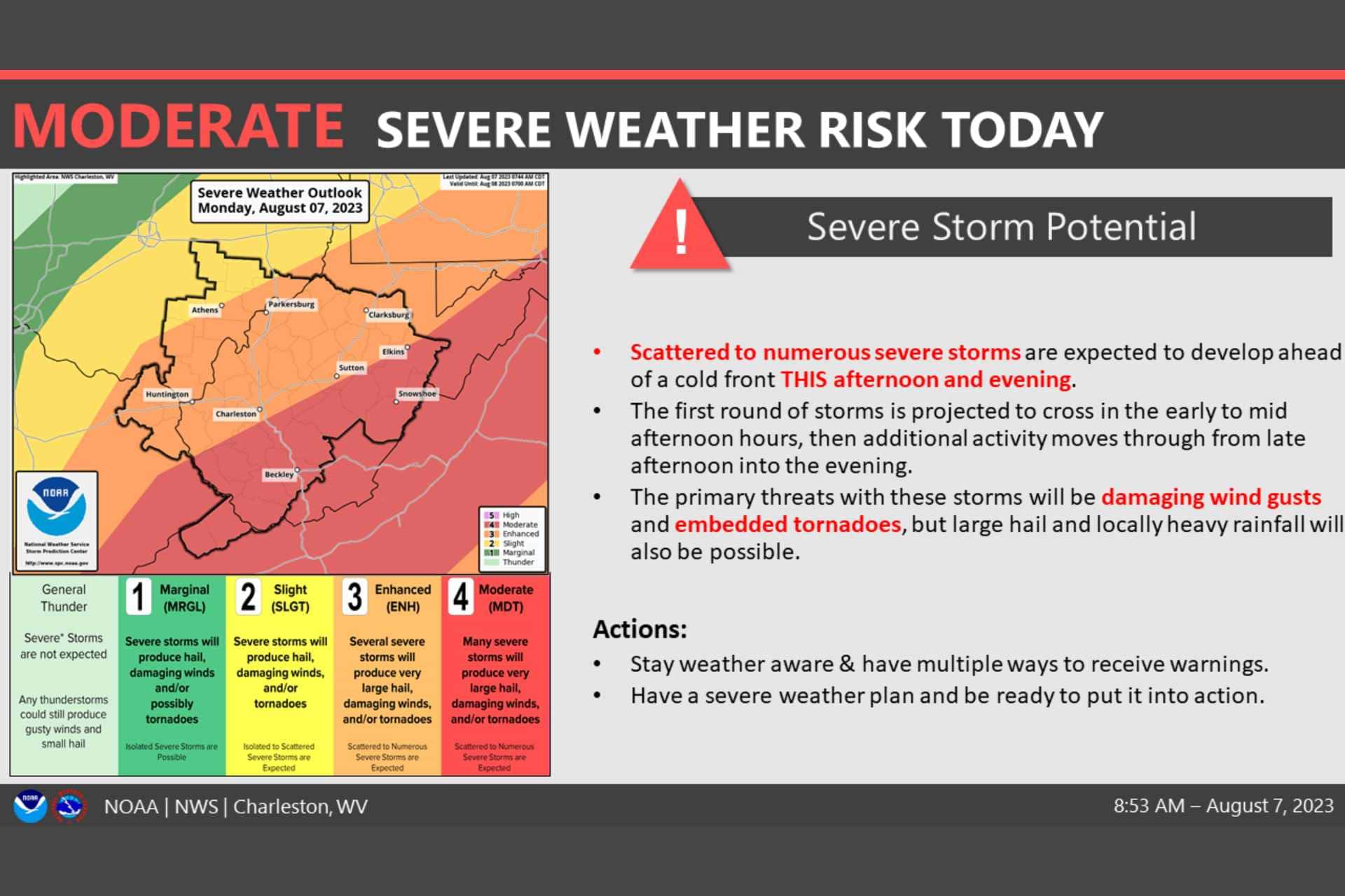
BUCKHANNON — The National Weather Service has issued a severe weather alert for Buckhannon as a strong system is due to hit the region Monday afternoon. Storms are expected to yield damaging wind gusts, large hail and isolated tornadoes as they travel northeast across West Virginia, prompting the NWS to issue an area-wide tornado watch that is in effect through 6 p.m.
The downpours that accompany this system could result in localized flash flooding, especially in low-lying areas.
Multicell clusters started spawning in the southwest and the western side of the state early this afternoon. The atmospheric parameters are comparable to conditions often seen in spring, with CAPE projected to exceed 2000 J/KG, sufficient to generate strong updrafts as a potent trough moves over the area.
Wind shear values are also high, with effective shear ranging from 40 to 60 knots, conditions favorable for the formation of supercells and tornadoes, according to the NWS. Despite these indicators, the actual chance for tornadoes remains relatively low compared to other hazards.

“The chance for tornadoes is low though compared to other factors,” according to the NWS. “Damaging [straight-line] winds will be the main concern, especially with crossover winds aloft hauling at 50-80kts and an amplifying low-level jet overhead.”
The final bout of storms will likely materialize later in the afternoon through the early evening as a cold front advances. Widespread damaging winds and potential spin-ups in the line can’t be ruled out, and repetitive downpours over the same areas or excessive rainfall rates could exacerbate flooding issues.
As for temperatures, it’s going to be a muggy and hot day, with lowland highs in the low to mid-80s and the mountains experiencing temperatures in the 70s and 80s. Dew points will be oppressive in the low to mid-70s.
Thankfully, more comfortable and quiet weather is predicted in the coming days. Drier conditions will start to build into the region later on Tuesday and Wednesday, following the passage of the cold front. There could be a return to rain on Thursday as another system rolls in, and the weather for Friday into the weekend looks to be near normal temperatures with daily chances for afternoon/evening showers and storms, especially in the mountains.