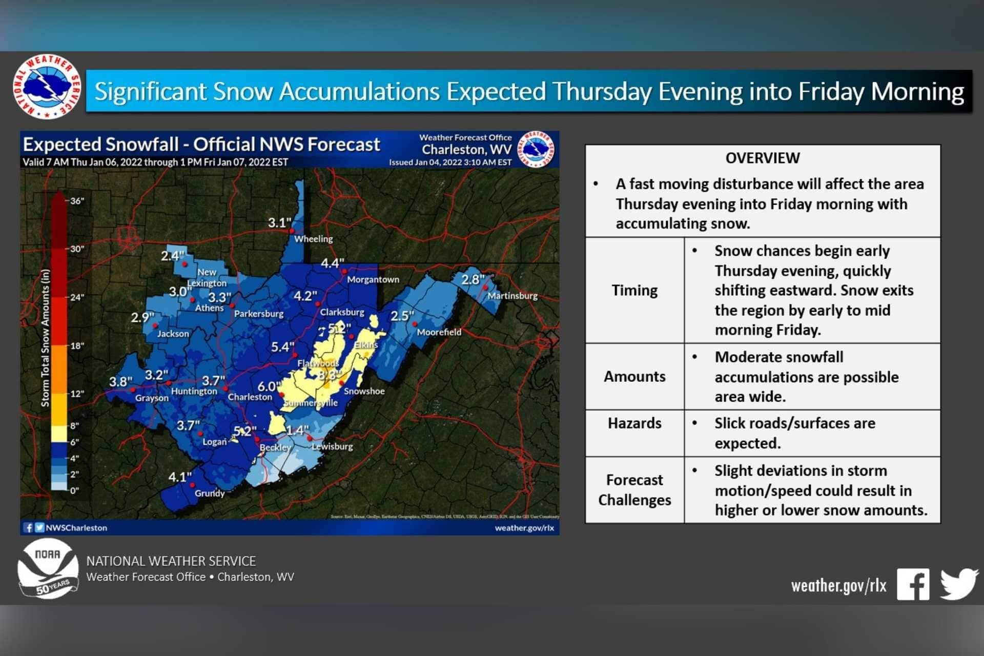
BUCKHANNON — The National Weather Service in Charleston issued an upgraded Winter Storm Warning covering much of West Virginia, including Upshur County, on Wednesday afternoon.
“Total snow accumulations of 4 to 8 inches are possible from noon Thursday to 8 a.m. Friday,” according to the warning. “Travel could be very difficult to impossible. The hazardous conditions could impact the morning or evening commute. If you must travel, keep an extra flashlight, food and water in your vehicle in case of an emergency.”
Thursday is expected to dawn sunny but cold, with a high of just 35 degrees. Snow is expected to move into the area after 4 p.m., with about an inch of accumulation during the day. Overnight, another 3 to 5 inches are possible, with most of the snow expected before 2 a.m. as temperatures plunge to 14 degrees.
The bulk of the snow is expected in the mountains, although lower elevations can still expect several inches, the NWS predicts.
“Up to 8 inches are expected in the higher elevations with localized higher amounts possible. Lesser amounts, up to 5 inches, can be expected across the lower elevation. Slick and hazardous travel conditions will likely develop by late Thursday afternoon and overnight Thursday night.”
Flurries could linger into Friday morning. Friday will be cold, with a forecast high of 24 degrees and a low of 10. More season weather returns over the weekend, with temperatures in the 40s and 50s.