BUCKHANNON – Did you know the half-dozen spots kayakers, canoers and fishing enthusiasts utilize to access the Buckhannon River were actually constructed as part of a local flood control project?
Six of the river access points within the City of Buckhannon – including boat ramps at North Buckhannon Riverfront Park and the Elizabeth J. “Binky” Poundstone Memorial Riverwalk Trail – weren’t built with outdoor adventurers in mind, yet they benefit from them today.
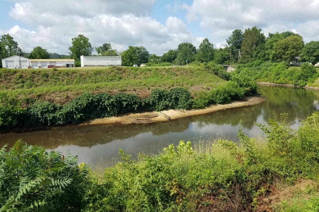
Those six access points were built as part of a U.S. Army Corps of Engineers’ local flood control project designed to prevent blockages that could potentially worsen flooding and detrimentally impact residents in downstream communities. In fact, those spots the water wayfarers of today now enjoy were constructed primarily to enable U.S. Army Corps of Engineers’ officials to access the river, city engineer Jay Hollen recently explained.
“They (USACE) put slope protection at several of the bridge locations for their bridge abutments,” Hollen said on a Friday morning in early December at the North Buckhannon Riverfront Park access point. “They also constructed six river access points that can now be used by kayakers or boaters, but during the project, it was for the contractors to move their equipment in and out. They strategically located these six access points, and they installed a river gauge down by the second bridge that allows us, even to this day, to monitor the depths of the river so we can see when the waters are coming up and when they’re going to be reaching flood stages.”
In 2022, the City of Buckhannon plans to prioritize cleaning dead vegetation, debris and other materials out of a section of river that comprises the Buckhannon Local Flood Protection Project the Army Corps completed in 1969. Following a several-year hiatus in funding allocation, city council in Spring of 2021 allocated $70,000 for flood control in its 2021-2022 fiscal year budget at the urging of finance and administrative director Amberle Jenkins.
Prior to that, the city only had about $8,000 in its flood control account.
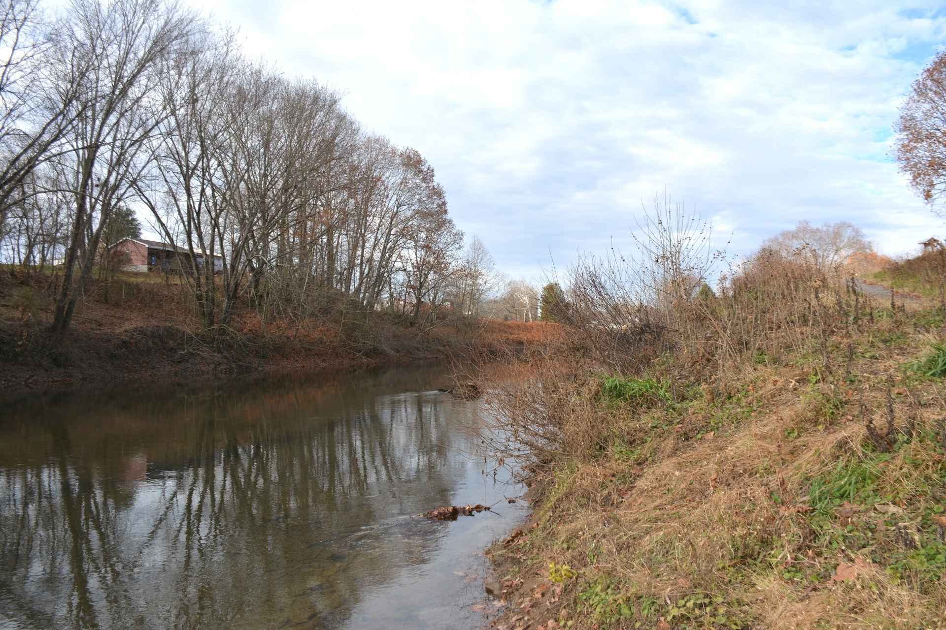
As Hollen noted, the Army Corps built those river access points in the mid-to-late 1960s as part of a Local Flood Protection Project following a slew of flooding events in Upshur County. Plans for the project were drawn up in 1962 and it was completed in 1969.
Hollen said it ultimately reduced flooding by an estimated 81 percent.
“Back then, there had been a series of floods – not just the Flood of 1918, which was then the Flood of Record – but this series of flooding events after that and prior to the [project’s] construction in ’67 that just kept damaging the low-lying areas, the houses and everything,” he explained. “It was just repetitive flooding over and over, and they said ‘enough’s enough, let’s fix this,’ and that’s when they widened the river, and they deepened the river.”
Stretching from the Island Avenue Bridge to the abandoned bridge on the Hall Road past Weyerhaeuser, the local flood control project comprises just over 4.5 miles of river distance and more than 9 miles of riverbank. The Army Corps widened the river, deepened the river and removed material, such as debris and dead vegetation, all along that four-and-a-half miles of river.
“The reason it was constructed was to reduce the flood damages in these areas that were experiencing multiple flood events,” Hollen said. “When they were finished with the design and construction, they estimated that the damage caused by flooding events was reduced by 80 percent or slightly more, so it was an effective project in their eyes.”
Today, when the city is experiencing heavy rainfall, the gauge the Army Corps installed still serves as a key tool city officials use.
“When we’re getting a lot of rainfall, that’s what we check, because it tells us what the depth of the water is,” Hollen said.
Twenty-one feet high is indicative of minor flooding events, 23 feet qualifies as a legitimate flooding event and 25 feet or higher means the area is experiencing a major flooding event.
“The Flood of Record now, which is the ’85 flood, it was 32 feet, but that river gauge is still operating and gives us an idea [of the state of the river] and I monitor it on a daily basis so that we can keep an eye on it and get in front of these potential flooding events,” Hollen said.
Since 2011, the Army Corps has inspected the project every two years, and in September 2021 sent the city a letter saying the project was “minimally acceptable” and needed some maintenance.
“It’s not nearly as bad as it sounds, but the Corps wants us to stay on top of it by addressing the vegetation both upstream and downstream of the bridge abutments by removing any trees or shrubs, and we’re in the process of doing that,” Hollen explained. “We need to remove all debris from the riverbed, remove all dead vegetation and trees from the riverbed, remove all dead vegetation and trees from the riverbanks, and identity and monitor any leaning trees.”
Debris and dead vegetation removal prevents flooding from worsening.
“They don’t want that debris floating down to the next community or to the next area that’s subject to flooding, blocking areas,” he said. “For example, we’ve had trees block the Island Avenue Bridge and the water backs up, and then it floods, and we don’t want that. We’re doing our part to keep the towns and communities downstream from flooding.”
A clear river channel also enables floodwaters to recede more quickly than they otherwise would.
“If the channels are clear and free, and there’s nothing but an open channel that the water can flow through, it can flow through faster, which means it’s going to recede quicker, which means the resulting damages aren’t going to be as bad,” Hollen said.
Hollen said the city’s plan now is to continue allocating money for flood control maintenance on an annual basis.
“It’s a perpetual project,” he said. “It doesn’t stop growing: Things are always falling in, stuff is always washing into the river, or people are throwing stuff away – I wish they wouldn’t, it’s a shame. The plan is to continually fund the project on a yearly basis, just keep going. Wherever we were at the previous year, we would pick up from that point and continue with the guidelines that are set forth in the Army Corps project description.”
An excavator, bulldozer and winch on a bulldozer are utilized to remove the material. The city plans to contract the work out, and it will likely take place during the late spring and early summer or late summer and early fall to avoid interfering with spring and fall fish spawning seasons.
“We can only be in the river a certain amount of time; instead of having the whole year to work, we’ve got a three or four-month window,” Hollen said.